Calgary Outdoor Recreation Association, CORA, Evening Hikes, hiking, Kananaskis county, scrambling, Shoulder season, Uncategorized

Prairie Mountain Night Hike 04.04.2013

As spring is making its way slowly into beautiful Alberta it was time to commence with some conditioning for the coming Hiking and Scrambling Season as well as to prepare for my upcoming assignment as a professional hiking guide for Timberwolf Tours in June of this year. I organized this Evening hike as a volunteer organizer for the Calgary Outdoor Recreation Association (CORA).

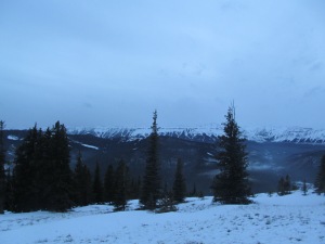
The last meters before the meadow

The last meters before the meadow

Banded Peak in the far south

Banded Peak in the far south

Here are a few facts about Prairie Mountain: The trail is an unofficial trail  and has become the spring conditioner before the winter gates open on Hwy 66 which gives access to some more hikes such as Powderface Ridge and Nihahi Ridge. Access to these hikes is closed from December 1st to May 15th.

The last push to the summit at 1km distance

The last push to the summit at 1km distance


The elevation gain is 716 m with the highpoint at 2210 m above sea level. the first 350 vertical meters is a corkscrewing trail up the southeast face of the mountain. At the midpoint the trail flattens out on rocky terrain , followed by the last step push up to the wind-buffeted meadows.

The big brother of prairie mountain. (Iyarhe wida tagichuwaga) Stoney

The big brother of prairie mountain. (Iyarhe wida tagichuwaga) Stoney

Nihahi ridge in the west

Nihahi ridge in the west


From there the final ascent is quite easy until you reach the cairn. From here the views are quite substantial. On clear days you can see Calgary to the East in the distance and , Moose Mountain in the North, Nihahi ridge in the West, and Banded Peak in the south. Today was a more overcast day with patches of fog so our visibility was not as good as other days.

It was a great hike with eight fellow hikers including experienced scramblers, a mountain runner and mostly leisure hikers like myself.

Happy hikers

Happy hikers


The trail itself was in a typical condition for Alberta spring, with Snow, Ice covered sections as well as bare rock and mud. The steepest sections were snow and Ice covered and we needed our Micro Spikes for most of the way

Muddy and snowy conditions

Muddy and snowy conditions


Our first group member arrived at the summit after 47 minutes and myself with taking pictures and “smelling the roses” after 1 hr and 20 minutes. The usual time for this trail, especially with good trail conditions is about 1 hr and 15 for some trail runners under 1 hr.

We spent a few minutes on the windy summit and enjoyed the wonderful clean air and the stunning views over the foothills and the Western range of the Rocky Mountains.

Dusk and mountains

Dusk and mountains

As we commenced our decent the light reached dusk conditions which brought out the contrast between the  rock and the snow of the surrounding mountains.

Beauty

Beauty


Half into our descent we had to use our headlights to descent safely over snow ice and rock. We all took our time and enjoyed the peace and tranquility of this wonderfull part of nature.

We had a very pleasant temperature of about 4 degrees throughout our outing and it was one of the first days when a cap and gloves were not really needed except at the summit were the strong SW wind created some chilled moments.

After a beautiful 2 1/2 hours on the trail we reached the closed off portion of Hwy 66 and made our way back to our cars, which will carry Us back to reality, the city it’s lights and noises, until the weekend when we will venture out again to our favorite playground the Rocky Mountains.

The winter closure gate at HWY 66

The winter closure gate at HWY 66

On the closed section of HWY 66

On the closed section of HWY 66


Standard
Aspen trail, Bob Truman, Calgary Outdoor Recreation Association, CORA, Family day, Kananaskis county, Kovach trail, nordic skiing, Ribbon Creek, Ski here, Terrace trail

Kananaskis Village Family Day Nordic ski trip.

DISCLAIMER: THIS BLOG ONLY REFLECTS MY PERSONAL OPINION AND IS NOT A GUIDE FOR NORDIC SKIING OR HIKING
ALL CONTENT IN THIS BLOG IS THE PROPERTY OF THE OWNER (Roland Laufer) INCLUDING ALL PHOTOS AND GRAPHICS.

After the exceptional snow fall in Kananaskis county, Alberta over the weekend of Feb 16-17 Me and 2 other members of the Calgary Outdoor Recreation Association (CORA) had the pleasure to be skiing in the beautiful Ribbon Creek trail area.

Trail system map

Trail system map

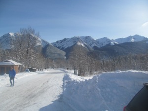
We left Calgary at 9:00 under a grey overcast sky and as soon as we entered the Kananaskis county the clouds lifted and made the foothills shine in the beautiful winter sun.

Parking Lot Ribbon creek view to the south.

Parking Lot Ribbon creek view to the south.

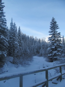
Ribbon Creek trail

Ribbon Creek trail

We arrived at the Ribbon Creek Trail head at 10:30 and the temperature reached -1 celsius. The last snowfall of 15cm, created a wonderful scenery and extremely good ski conditions.

The trail system was groomed the night before and thanks to the great updates on Bob Truman’s website lots of Skiers joined us on the parking lot.

Our small group consisted of advanced, intermediate and beginners level skiers. We looked forward to a great day.

Ribbon Creek

Ribbon Creek

We commenced our day on “Ribbon creek” trail, which gradually climbed through the snow-covered trees and connects to the “Link” trail (0.8 km) after 2.2 km. This section starts with a slight downhill section, followed by a bridge crossing and climbs  gradually again. This trail connects after the bridge to the “Kovach” trail (3.00 km). It was in excellent conditions and we had great glide as well as grip with Wax less and the waxed skies. The blue wax my fellow skiers used worked great.

Ascent on Kovach

Ascent on Kovach

The ascent to the view-point, which is equipped with a picnic table was a challenging for some but definitely worth the effort. We paused at this point conversed with some fellow skiers and continued on “Kovach” to connect to the “Aspen” trail.

At Aspen Trail

At Aspen Trail

Aspen trail (1.9 km) is an easy to ski connector back to “Kovach”  to descent over “Terrace” (1.00 km) back to the parking lot. It opens a 2 points to a wonderful view on the surrounding mountains. After we skied half this trail we paused to replenish our energy with try fruit, protein bars and water. The temperature was still pleasant although in the open areas, the wind chill us down a bit.

After or break we continued on to join the “Kovach” (1.30 km) trail again. This section is mostly downhill, with some flat areas and slight uphill. A wonderful rolling section which we definitely enjoyed.

After a swift descent we arrived at our last intersection to “Terrace” (1.00 km) which we descended down to the parking lot. This trail is a great practice hill for beginners and intermediate skiers as it includes steep sections, tight turns as well as lighter descents and ends with a flat section at a bridge head. The descent was very pleasant once again because of the great snow conditions, which I hope will stay with us for awhile longer . Thankfully some more snow is indicated in the 7 Day forecast for the Kananaskis county area. Although we had a slower pace today I burned approximately 2200 calories during this time according to a online burn calculator

Back at trail head

Back at trail head

We arrived back at our transport at 2:15 enjoyed some lunch and returned to Calgary. Our original plan was to add some more trails to our day but some commitments in Calgary came up for the evening. We almost decided to turn back to the mountains as Calgary was still under overcast skies with a temperature of -6 celsius. Unfortunately we sometimes have to return to our everyday life on one point.

DISCLAIMER: THIS BLOG ONLY REFLECTS MY PERSONAL OPINION AND IS NOT A GUIDE FOR NORDIC SKIING OR HIKING

ALL CONTENT IN THIS BLOG IS THE PROPERTY OF THE OWNER (Roland Laufer) INCLUDING ALL PHOTOS AND GRAPHICS.

Standard